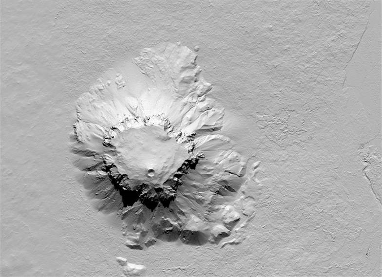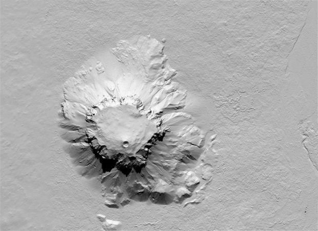
Herðubreið er með tignarlegri fjöllum, formfagurt og gnæfir meira en ellefu hundruð metra yfir umhverfi sitt á hálendinu. Þetta fjall varð fyrir valinu við gerð nýrra hæðgargagna hjá Landmælingum Íslands, þ.e. vinnslu ArcticDEM hæðargagna frá Polar Geospatial Center (PGC) í Bandaríkjunum. Sú stofnun fær m.a. stuðning frá NSF (National Science Foundation). Gögnin eru unnin með gervitunglamyndum, einkum WorldView.
Hæðarlíkanið fyrir Herðubreið (2-m-pixilstærð) er unnið úr mynd sem tekin var 16. júlí, 2012 en göt í því eru fyllt með gögnum úr þremur öðrum myndum. Leitast var við að „hreinsa“ galla úr frumgögnunum og leiðrétta fyrir geoiðu Íslands. Eftir hæðarlíkaninu var síðan gert 2-m-hæðarlínulag. Gögnin sýna hæsta hluta Herðurbreiðar við norðurhluta gígsins sem er í kolli fjallsins og reynist hann vera í 1674.69 m. Eldri hæðartala fyrir Herðubreið er 1682 m, þ.e. sú hæð sem dönsku Herforingjaráðskortin sýna.
Herðubreið er stapi, myndaður við eldgos undir jökli. Hraundyngja myndar efsta hluta fjallsins, um 150 m þykk. Eldgosið hefur upphaflega hlaðið gosbergi upp í gegnum ísinn þar til hraun tóku að myndast, svipað og í Surtseyjargosinu (1963-1967). Hæðin frá rótum fjallsins að hraundyngjunni var um 1 km og má ætla þykkt jökulsins á þeim tíma hafi verið svipuð.
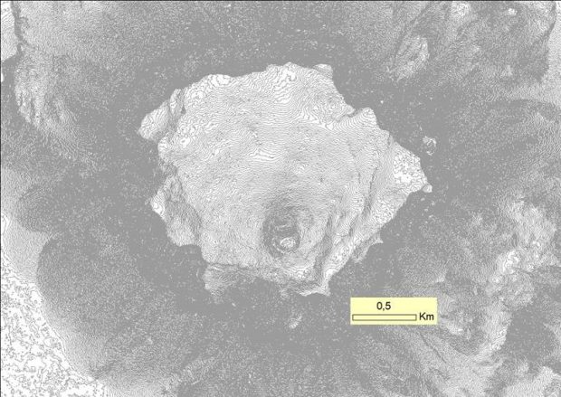
Þegar gengið er á Herðubreið er jafnan farið upp á fjallið að norðvestanverðu (stundum dregin lína frá Kollóttudyngju til Herðubreiðar). Þar frá jafnsléttu uppá hæsta tindinn í kolli fjallsins er innan við 3 km vegalengd. Með hliðsjón af 2-m-hæðarlínum má sjá hvar halli upp eftir fjallinu er hvað minnstur.
Nálgast má gögnin á niðurhalssíðu Landmælinga Íslands.
Herdubreið – ArcticDEM
Mt. Herðubreið, NE Iceland, rates among the most spectacular mountains in Iceland. It has a beautiful shape and extends over its highland
environment by as much as 1100 meters. This mountain was selected when updating new elevation data by the National Land Survey of Iceland. The elevation data involved are referred to as ArcticDEM and originate from the Polar Geospatial Center (PGC) in the US. This institute is funded by the US National Science Foundation and the elevation data is derived from stereo pairs of satellite images, mainly WorldView1 to WorldView3.
The DEM for Mt. Herðubreið (2-m-pixel size) is primarily made from an image that was obtained on July 16th, 2012. It does have holes that were filled with data from three other images.
An attempt was made to „clean“ defects from the original data and correct the DEM for Iceland´s geoid. A 2-m-contour dataset was made from the DEM. The data show the highest peak of Herðubreið on the northern side of a volcanic crater on the mountain top. According to the new data the Mt. Herðubreið highest point is at 1674.69 m a.s.l. The older elevation for Mt. Herðubreið is at 1682 m, according to the Danish military maps.
Mt. Herðubreið is a table mountain (tuya) that was formed beneath an ice sheet during the last glaciation. The top segment, about 150-m-thick, is a lava shield. Originally, the eruption built up volcanics through the ice sheet to a level where lavas began to form, similar to what happened in the Surtsey volcanic eruption south of Iceland (1963-1967). The elvation from the mountain foothill toward the lava shield lower boundary is approximately 1 km. Thus, it can be assumed that the ice thickness in the area at the time of eruption was of similar thickness.
When climbing Mt. Herðubreið it is customary to take a route up on the northwestern side (sometimes a line is drawn from Mt. Kollóttadyngja to Mt. Herðubreið). From the foothill on the northwest side up to the peak the distance is less than 3 km. This is also the route where the steepness is lowest based on 2-m-contour line examination.
The data can be downloaded from the National Land Survey website
